Ultra-High-Resolution Satellite Imagery Could Soon Be Available to Everyone
The Secret? Flying Closer to Earth
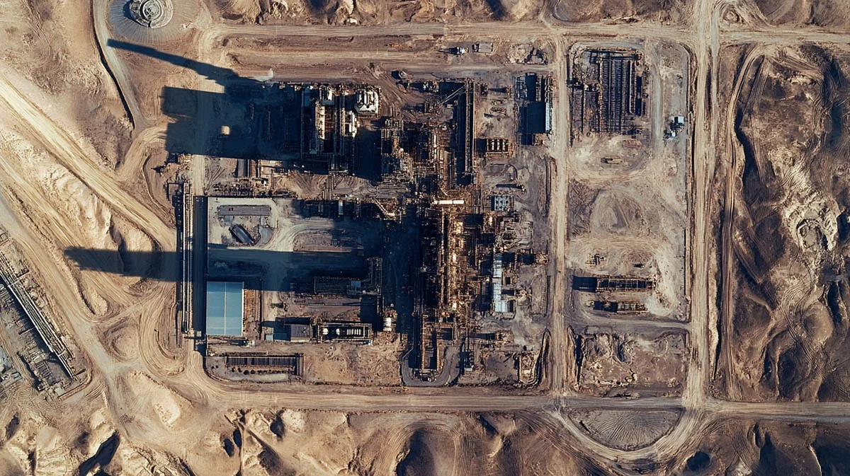
It all started with a tweet. In 2019, during his first term as U.S. president, Donald Trump shared a surveillance photo of an Iranian missile site following an explosion. The unusually high quality of the image, combined with its angle and analysis by amateur satellite trackers, led experts to a startling conclusion: Trump had likely posted a highly classified image from one of America’s top-secret spy satellites.
The most remarkable aspect was the sharpness of the photo. While commercial satellite imagery—offered by firms like Maxar and European Space Imaging—typically achieves a resolution of about 30 cm per pixel, the image in Trump’s tweet appeared to be closer to 10 cm per pixel. Since image resolution improves with the square of the distance, this meant the image was approximately nine times sharper than standard commercial offerings.
For many, this level of detail was astonishing and seemingly unattainable outside of classified military programs. “Part of the conversation was how amazing it would be if you could get that sort of resolution commercially,” recalls Topher Haddad, an engineer who at the time was working on satellites at Lockheed Martin. However, the assumption was that such technology would remain prohibitively expensive—after all, America’s most advanced spy satellites are rumored to cost several billion dollars each.
But Haddad saw an opportunity. In 2020, he and two colleagues founded Albedo Space, a company dedicated to bringing 10 cm-resolution imagery to the commercial market. Four years and nearly $130 million in funding later, the company is preparing to launch its first satellite, Clarity-1, in March. With plans to deploy up to 24 satellites, Albedo aims to provide unprecedented high-resolution images to industries ranging from insurance and agriculture to utilities and government agencies.
The Key to High-Resolution Imagery: Flying Low
Spy satellites function like telescopes pointed downward. Their resolution primarily depends on two factors:
- Mirror size – The larger the mirror, the more light it gathers, improving clarity.
- Distance from the target – The closer the satellite is to Earth, the sharper the images.
Albedo is focusing on the second factor by deploying satellites in what is known as Very Low Earth Orbit (VLEO)—just 320 km above Earth, significantly lower than most commercial satellites. Since image resolution scales with the square of distance, even a modest reduction in altitude yields substantial gains in image sharpness.
However, operating in VLEO presents unique challenges. While the atmosphere is thin at this altitude, it still generates enough drag to pull satellites out of orbit in just a few months. To counteract this, Albedo’s satellites will use electric propulsion systems, which generate small but highly efficient thrust to maintain altitude.
Design modifications are also essential. Unlike traditional satellites, which often have solar panels extending outward, Albedo’s satellites will have flush-mounted panels to reduce drag. The continuous atmospheric resistance also complicates image capture, as even slight changes in orientation can significantly alter the forces acting on the satellite.
Additionally, objects in lower orbits move faster than those in higher ones, making precise imaging more difficult. The satellites must also withstand exposure to corrosive atomic oxygen, which requires specialized materials and coatings.
Despite these hurdles, careful engineering should allow Albedo’s satellites to operate for an average of five years, though actual lifespan will vary based on the 11-year solar cycle. During periods of high solar activity, the upper atmosphere expands, increasing drag and shortening satellite lifetimes. However, the recent dramatic reduction in launch costs makes replacing satellites more affordable than ever.
Demand is Already Surging
Even before its first satellite has launched, Albedo is seeing strong demand. Haddad says all of Clarity-1’s capacity for the next two years has already been sold to clients spanning multiple industries, including:
- Energy sector – A gas pipeline operator
- Mining – A company specializing in geological imagery
- AI & Analytics – ScaleAI, which uses artificial intelligence to analyze satellite data
High-resolution satellite imagery is already widely used across industries unrelated to space. Insurance companies rely on it to assess claims after natural disasters and even evaluate risks in advance. Agricultural firms use it to monitor crop health, while hedge funds track economic activity by analyzing oil storage levels and parking lot occupancy at major retailers.
Albedo’s 10 cm-resolution images could open entirely new markets. Today, utilities and infrastructure companies rely on aircraft and drones to inspect power lines, oil pipelines, mines, and solar farms. If Albedo can deliver similar quality imagery from orbit, it could significantly cut costs while increasing coverage. Moreover, once Albedo has a full constellation of satellites in operation, it will be able to capture multiple images of the same location several times per day, something neither aircraft nor drones can easily achieve.
Governments Are Taking Notice
Some of the most enthusiastic customers may be governments. A portion of Clarity-1’s imaging capacity is reserved for the U.S. government, though recent changes in export regulations now allow Albedo to offer services to many other nations as well. These countries would otherwise struggle to develop such capabilities on their own.
However, the U.S. government’s willingness to commercialize this level of resolution raises an intriguing question: If 10 cm imagery is now being made public, just how advanced are the latest classified spy satellites?
One thing is certain—high-resolution satellite imagery is on the cusp of becoming more accessible than ever, and its implications for business, security, and technology will be profound.
Related New: